Client:Urban Administration & Development Department (UADD)
Year: 2015
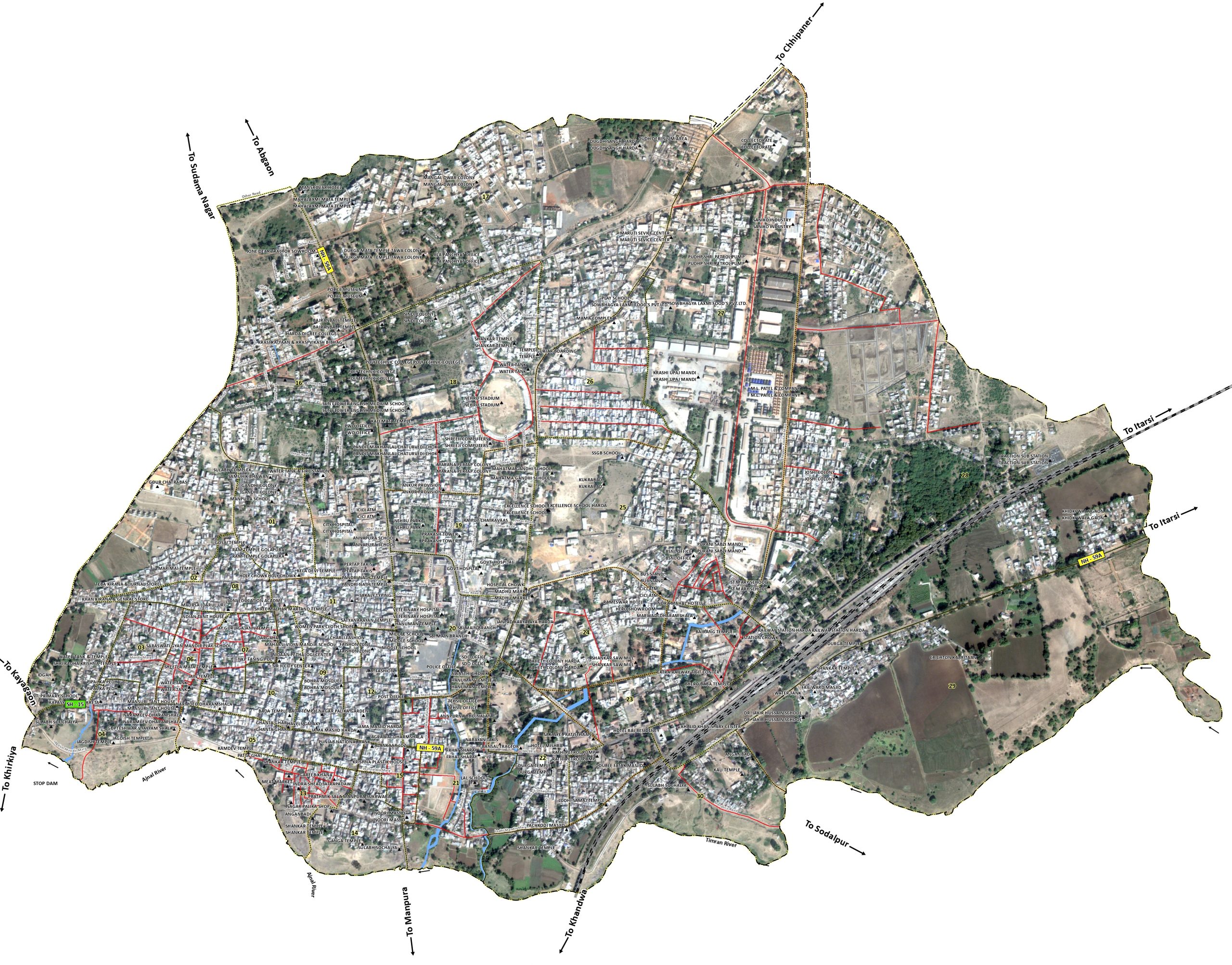
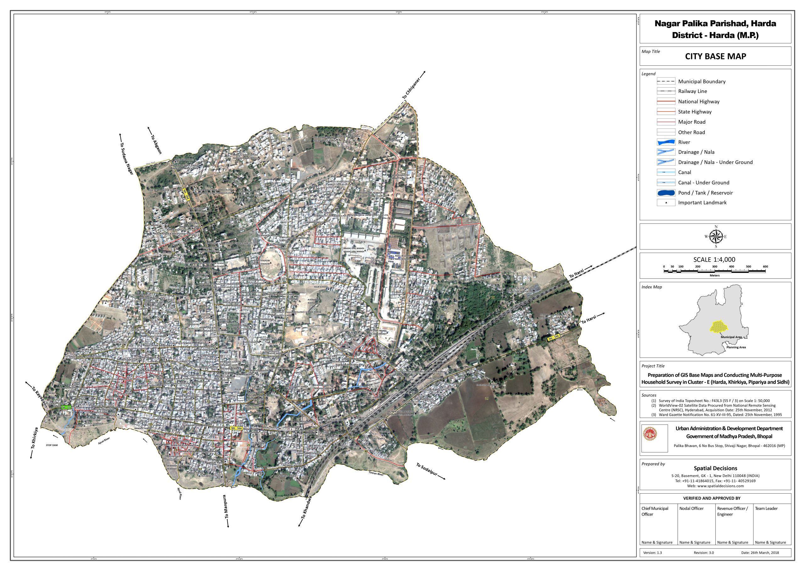
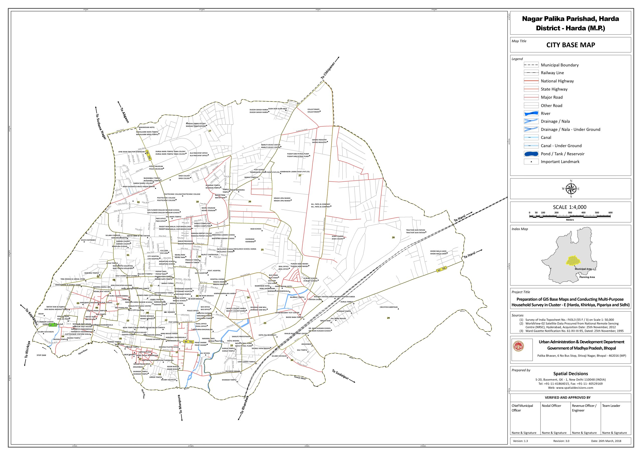
Under The Madhya Pradesh Urban Services for the Poor programme with UADD Govt. of MP, to facilitate the range of project activities anticipated for Singrauli, it was proposed to develop GIS Base map derived from high resolution satellite imagery & socio-economic household survey to develop a common geospatial Database. Using this imagery, a preliminary vector database was anticipated to be developed based on existing GIS data as well as the creation of new data.
Procurement of Quick Bird satellite imagery products, assistance in procurement, and development of vector geo-database comprising, line features and polygonal features, complete with attribution. Specific activities involved:
• Base map creation using Quick Bird Imagery
• DGPS Survey for Capturing Ground Control Points (GCP’s)
• Socio-Economic Household field survey Field for approx. 40,000
• Properties & Slums
• Integration of Socio-economic survey data with GIS layer to create
• Geo-spatial Database
• Development of GIS database using RDBMS Concepts
• Setting Data Quality and Verification Standards
• Designing Training Manual and Guidance Document
• Organizing and conducting training Programme on Geo-spatial